
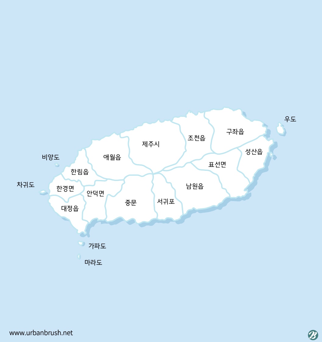
제주도 지도 일러스트 ai 다운로드 Download jeju island map vector
Tommy의 이미지가 맘에 드나요?
디자이너 Tommy입니다. 제가 올린 이미지 편집이 필요하거나, 새로운 디자인 의뢰(로고, 브랜딩, 웹디자인, 마케팅 홍보물-리플릿, 포스터, 전단지, 캐릭터 등)가 필요하시다면, 아래 '디자이너 Tommy에게 의뢰하기, 버튼을 눌러 의뢰해주세요.


카톡상담


Terms of service
[이용약관] 이 이미지는 이용약관을 확인 후 사용해야 합니다. 다음은 유료 이미지 이용약관을 요약한 것이며 상세한 내용은 이곳을 클릭하여 확인하시길 바랍니다.
- 파일은 다운로드 후 구매자가 안전하게 보관해야 하며, 어반브러시는 재다운로드를 보장하지 않습니다. 다운로드 한 파일은 구매자만 사용할 수 있으며, 원본 파일을 그대로 다른 사람에게 판매하거나 제공, 배포할 수 없습니다. 유료 다운로드 한 파일은 기본 사용라이센스가 포함되어 상업적 이용이 가능하며, 다른 이미지와 함께 원형을 사용하거나, 가공된 이미지에 사용하여 판매할 수 있습니다. 유료 이미지를 구매 후 구매자 본인(또는 회사)에 한해서 사용기한, 사용처에 대한 제한이 없습니다. 이미지를 사용하여 상표를 만들어 상표권을 취득하거나, 특허권이 있는 제품에 사용하기 위해서는 라이센스를 받아 사용해야 합니다. 원본 파일 소스를 타 사이트에 그대로 재배포해서는 안 됩니다. 판매 이력이 없어 독점구매가 가능한 경우 판매 가격아래 표시가되며, 독점구매를 원하시면 디자이너 또는 어반브러시에게 별도 문의 후 구매 안내를 받으셔야 합니다. 독점구매상품은 구매 후 ‘판매완료(Sold Out)’으로 표기되며 최초 구매자 이후 더 이상 구매가 불가합니다.
Tommy
카톡상담
포트폴리오
디자인문의
의견을 남겨주세요!
의견을 남기시려면 로그인해야합니다.